Quakefinder Blog

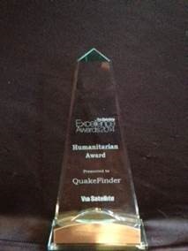
QuakeFinder is awarded the 2015 VIA SAT Humanitarian Excellence Award

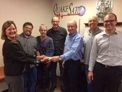
QuakeFinder was awarded the VIA SAT Humanitarian Excellence Award for 2015 at the recent Satellite 2015 Conference in Washington DC. The award is given to a company or group that uses satellites to promote the welfare of mankind. In this case QuakeFinder uses both ground (QuakeFinder 165 site Magnetometer network) and space( the GOES weather satellite’s IR camera) to develop a system to forecast large earthquakes days before they happen. This research is ongoing and is refining a system to detect these devastating earthquakes, and ultimately to save lives. Congratulations to the QuakeFinder Team (below)  
QuakeFinder Network detects and characterizes the recent “Mega-Solar Storm” that hit Earth March 16-19.

Space weather affects us on earth and it manifests itself as larger northern light displays, as potential satellite damage, and as potential power outages due to induced currents in power lines. QuakeFinder’s network is able to show how much the magnetic disturbances affect specific areas in California, based on the differences in ground conductivity.     Example 1 Before the solar storm started: Green bars are magnetic index form NOAA space weather website. Green means that there is low solar activity and low magnetic disturbances on earth.   Red plot is the North-South magnetometer at our Parkfield site in central California. Green plot is the East-West magnetometer at Parkfield. Blue plot is the vertical magnetometer at Parkfield. 24 hours across the time axis (Pacific Standard Time and UTC time).       Example 2  During the solar storm where a large signal is observed at a location where there is a known salt water submerged lake (Parkfield): Yellow and red bars show the level of a large magnetic storm (Magnetic index Kp from NOAA Space Weather website). .     These same signals are observed at all our magnetometer sites, but some are lower than others due to ground conductivity. Example 3  During the solar storm but where a smaller signal is observed at a site in a dry mountainous area:  

Collaboration in Chile

Tom Bleier and Jon Riley recently travelled to Chile to upgrade the communication systems at several previously installed sites. After getting the upgraded cell and fiber systems working, we focused on developing collaboration partners in Chile who will work with us to develop an operational earthquake warning system in that country. We visited several universities (PUCC – Pontificia Universidad Católica de Chile, University of Concepción, and UNAB – Universidad Andres Bello), and contacted several commercial companies (EnorChile, GOA Projects and Investments, and General Electric), as well as CIGIDEN – National Research Center for Integrated Natural Disaster Management, to develop those partnerships. PUCC and the CIGIDEN group in Santiago, including Juan Carlos, Juan Soto, and Santiago Barros were very responsive in agreeing to help maintain the initial 4 instruments which QuakeFinder donated, developing a new initiative to help in the research, and to solicit funding to expand the initial network to areas where future large earthquakes may occur. Rodrigo Abarca and Elias Ovalle of the University of Concepción took the lead in adding their expertise in ionospheric studies to the repertoire of electromagnetic phenomena that we wish to study and fuse together. Felipe Lobos is helping maintain the site in Iquique. Miguel Pradenas (UNAB) is helping with the site in Quintay. Ariel Cesped (GE) is helping at El Tabo, and is adding his experience with infrared processing. Overall, a great spirit of cooperation and collaboration in Chile. The photo at the left shows our site in El Tabo, and at Iquique (Atacama Desert) on the right.

Installing 4 New Sites in Sumatra

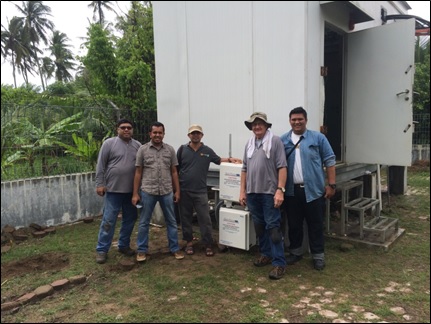
Tom Bleier and Bob Camins recently travelled to Banda Aceh, Indonesia, the site of the 2004 M9 earthquake and tsunami which killed over 200,000 people along the western coastline. During this trip, we received excellent support from partners Dr. Teuku Reza Ferasyi from Syiah Kuala University, and from Aidil Adhari, the local Tower Bersama (cell tower company) representative who helped us install the instruments inside their cell tower security enclosures. We installed instruments near Banda Aceh and every 40 km southward along the coastline, facing the famous subduction zone fault line. The installations were difficult due to heavy rain and high temperature/humidity, but the team of QuakeFinder, Syiah Kuala University, and Tower Bersama worked really well together to get the job done on time. In addition to the in-country team, many thanks are due to the “home” team, including Clark Dunson, who handled several midnight calls for support back in the Bay Area, and Jim Lemon, who kept a vigilant eye on the status of systems after they were installed. The Banda Aceh area is calm now and does not show much of the damage and heartbreak from the 2004 tragedy. We hope this joint effort for earthquake forecasting research will help to lessen the loss of life from future earthquakes. Team in Sumatra